Back جبل مونت مونادنوك ARZ Monadnock Mountain (bukid sa Tinipong Bansa, New Hampshire) CEB Mount Monadnock Czech Mount Monadnock German Monte Monadnock Spanish کوه مونادناک Persian Mont Monadnock French הר מונדנוק HE Monte Monadnock Italian Mount Monadnock LLD
| Mount Monadnock | |
|---|---|
| Grand Monadnock | |
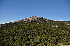
 The summit of Mount Monadnock | |
| Highest point | |
| Elevation | 3170 ft (966 m)[1] |
| Prominence | 2130 ft (649 m)[2] |
| Listing | #33 New England Fifty Finest |
| Coordinates | 42°51′41″N 72°06′29″W / 42.861379303°N 72.108070722°W[1] |
| Geography | |
| Geology | |
| Age of rock | 400 million years |
| Mountain type | Monadnock (Inselberg) |
| Type of rock | Littleton formation schist/quartzite |
| Climbing | |
| First ascent | 1725 by Captain Samuel Willard (first recorded) |
| Easiest route | White Arrow Trail, 2.3 mi (3.7 km) |
| Designated | 1987 |
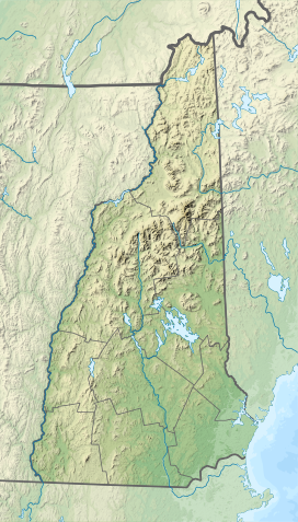
Mount Monadnock, or Grand Monadnock, is a mountain in the towns of Jaffrey and Dublin, New Hampshire.[3] It is the most prominent mountain peak in southern New Hampshire and is the highest point in Cheshire County. It lies 38 miles (61 km) southwest of Concord and 62 miles (100 km) northwest of Boston. At 3,165 feet (965 m), Mount Monadnock is nearly 1,000 feet (305 m) higher than any other mountain peak within 30 miles (48 km) and rises 2,000 feet (610 m) above the surrounding landscape. Monadnock's bare, isolated, and rocky summit provides expansive views. It is known for being featured in the writings of Ralph Waldo Emerson and Henry David Thoreau.
Mt. Monadnock has long been cited as one of the most frequently climbed mountains in the world.[4] It bears a number of hiking trails, including the 110-mile (180 km) Metacomet-Monadnock Trail and the 50-mile (80 km) Monadnock-Sunapee Greenway.[3] The summit is barren largely because of fires set by early settlers. The first major fire, set in 1800 to clear the lower slopes for pasture, swept through the stands of virgin red spruce on the summit and flanks of the mountain. Between 1810 and 1820, local farmers, who believed that wolves were denning in the blowdowns, set fire to the mountain again. The conflagration raged for weeks, destroying the topsoil and denuding the mountain above 2,000 feet (610 m).[5]
The term "monadnock" is used by American geologists to describe any isolated mountain formed from the exposure of a harder rock as a result of the erosion of a softer one once surrounding it (a landform termed "inselberg" ("island-peak") elsewhere in the world).
- ^ a b "Monadnock". NGS Data Sheet. National Geodetic Survey, National Oceanic and Atmospheric Administration, United States Department of Commerce. Retrieved September 4, 2021.
- ^ "Mount Monadnock, New Hampshire". Peakbagger.com. Retrieved September 4, 2021.
- ^ a b DeLorme Topo USA 6.0. (2006). Mapping software. Yarmouth, Maine: DeLorme.
- ^ NH Division of Parks & Recreation: Monadnock State Park
- ^ Cite error: The named reference
baldwinwas invoked but never defined (see the help page).
© MMXXIII Rich X Search. We shall prevail. All rights reserved. Rich X Search

